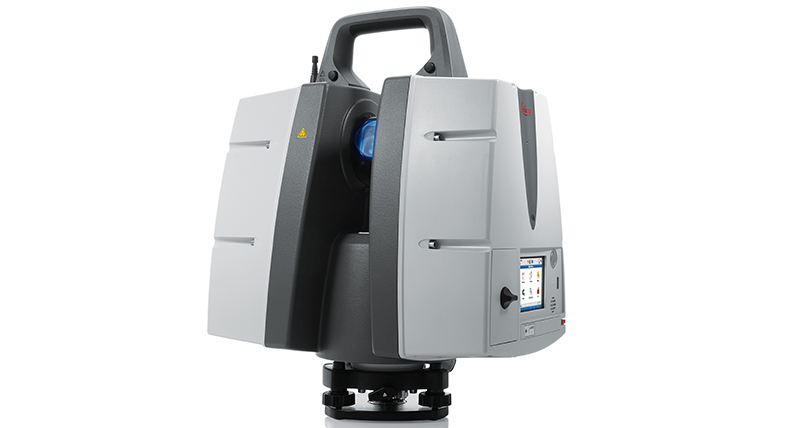
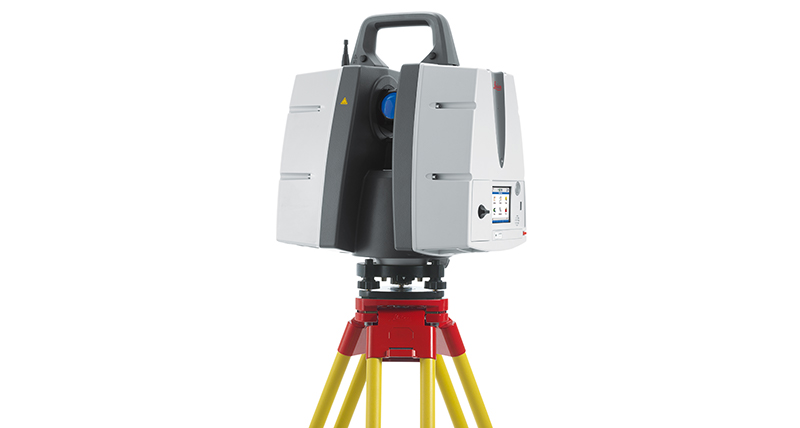
Leica ScanStation P50 - 長距離対応の3Dレーザースキャナー
設定手順を簡素化することで現場での作業時間を短縮し、人が立ち入りにくい場所であっても、安全な場所からのスキャンが可能となり、作業の生産性が飛躍的に向上します。

アクセスが難しい場所でもスキャンして新たなビジネス機会を見いだすための機能を提供する、Leica ScanStation P50は、業界の専門家向けの、最も高速で安全な、長距離対応の3次元レーザースキャナーです。 他のレーザースキャナーとは異なりP50であれば、より少ない設定手順で、立ち入ることのできない場所も安全な場所からスキャンできます。これにより現場での作業時間が短縮し、生産性が飛躍的に向上します。
Leica Geosystems 3D Reality Captureソリューションの一部として、現場で取得した3Dデータを Leica Cyclone Field 360アプリ経由で新たに ScanStation Pシリーズのレーザースキャナーとも接続が可能になり、さらに取得したデータの合成をオフィスPCから Cyclone REGISTER 360 を介して実施できるようになりました。ユーザーはスキャンデータと画像データを自動的に取得し、登録、確認を現場で直接できるようになりました。

正しい選択
超高層ビルの3次元データの取得、大規模インフラ施設のデータ記録、広大な採掘現場のスキャンなど、いずれの場合も長距離計測に対応した3Dレーザースキャナーが必要不可欠です。 P シリーズに新たに加わった Leica ScanStation P50 は、長距離スキャン機能を搭載した最適な選択肢です。ScanStation P50 はディテールも確実に取得するレーザースキャナーです。

高パフォーマンス
堅牢なLeica ScanStation P50は、–20°C ~ +50°C の過酷な温度環境でも 動作し、また、防水・防塵の規格である IP54 に準拠しています。

アクセスが困難な場所もスキャン
Leica ScanStation P50は、最高品質の3DデータとHDR画像を、毎秒100万点という非常に高速なスキャンスピードで実行でき、その最長計測距離は、1 kmまでとなっています。 抜群の測距範囲と角度精度、そして低レンジノイズと測量に適した2軸補正から、高品質のリアルな3次元カラー点群データを生成します。

スキャニングのトータルソリューション
Leica ScanStation P50は、ハードウェア、ソフトウェア、サー ビス、トレーニング、およびサポートの包括的なソリューションを提供し ます。 下記から構成される業界一の3D点群ソフトウェアスイートで、3Dレーザースキャナーが取得したデータを処理することができます: Leica Cyclone スタンドアローンソフトウェア、Leica JetStream、Leica CloudWorx CADシステム用のプラグインツール、そして無償版ビューアのLeica TruView。

Leica ScanStation P50の機能:
- 高品質の3DデータおよびHDR画像
- 100万点/秒の超高速スキャン
- 1kmの長距離スキャン
- 低レンジノイズ
- 2軸補正の測量
Leica ScanStation P50 データシート
Leica Cyclone FIELD 360 データシート
Conformity declaration
Leica ScanStation P30 / P40 CE conformity declaration
長距離対応のレーザースキャナーの操作方法
長距離の3Dレーザースキャニング
安全な距離からスキャン
PortCoast - 5ヘクタールの沿岸部の建設現場を3Dでキャプチャするために時間と波と戦う
Portcoast - 3Dレーザースキャニングでフーミー港の正確なデータを記録
レーザースキャン技術はどのように建設業界に変革をもたらしたか?
Surveying & Engineering
Exact scan of two cooling towers
Scan till you drop
Exploring the rate of climate change from deep in the Earth
Game on with laser scanning
Fitting together pieces of a puzzle
When every millimetre counts
Creating a new ski jump complex
How Hollis captures, processes, manages and delivers reality capture data
Surveying Germany's biggest aqua park
Capturing reality in one of the world's busiest airports
Building Construction / AEC
Reality capture for BIM
From paper maps to laser scans
Speeding up BIM-reconstruction
From tape to point cloud
Using laser scanning technology for retail redevelopment
Infrastructure
Off the boat, into the air
Advancing Mexico's transportation infrastructure
Improving the railway infrastructure of a capital city
Scan, spans and automobiles
Mirroring reality for rail
Setting the world's shortest railway back on track
Protecting heritage with upgraded rail clearance
Plants & Ships
Plain sailing with 3D plant design
SOS shipbuilding on scans
Sweet success in plant documentation
Bringing safety, productivity with laser scanning
Leica Geosystems laser scanners and Hexagon PPM 3D design software access 'true reality'
Revolutionising the luxury yacht building industry with laser scanning
How Element6 delivers the future of Plant Engineering with laser scanning
Renovating complex structures with 3D laser scanning
Fighting time and tide to capture a 5-hectare coastal construction site in 3D
Public Safety
How Johnson's County is recreating crime scenes with laser scanning
Changing the game for public safety professionals with the world's fastest laser scanner
Transforming reality into photorealistic Virtual Reality with laser scanning
Heritage
The reality capture of Ellis Island
# Digitising the mighty Taj Mahal
Predicting the future by analysing the past
The lower, the safer
Preserving mankind's past from mother nature's quake
Transforming Ayacucho into a digital city
Digitising Frank Lloyd Wright's desert laboratory
Digitalising the Spanish Royal Palace with laser scanning
Transforming ruins to 3D models
Preserving digitally Hukuru Miskiy
Capturing Egypt’s Sistine Chapel with the BLK360
Unveiling the mystery - an ancient water clock with laser scanning
Preserving Romania's speleological heritage with point cloud and GNSS data
Utilities
From the laser scanner to the office in near real time
Laser Scanners
Leica BLK2GO
Leica BLK360
Leica RTC360
Leica ScanStation P30 / P40
Software
Leica Cyclone
Leica CloudWorx
Leica TruView
Leica JetStream
Leica Map360
Accessories
3D Laser Scanning Accessories
Reality Capture Newsletter
The High-Definition Surveyor - Blog
The Power of Scanning
Quality is a tradition, built deep within our DNA. We have a commitment to excellence and exceptional attention to detail.
Quality is a tradition, built deep within our DNA. We have a commitment to excellence and exceptional attention to detail.


