Streamlining Urban Planning with 3D Laser Scanning
Case study

Author: Fernando Delgado, Carlos G. Guillermo Ramírez
As residents of big cities are increasingly looking for quieter, more rural settings, urban developers have seen an increased demand for housing in open environments. Spain’s Prádena del Rincón, a small village north of Madrid, has seen an influx of habitants moving out of Spain’s capital city. The demand from residents moving into the area has overwhelmed Spanish urban planning authorities as they look to navigate and plan the movement of people.
Although many sources of geospatial information are available in Spain, they are not helpful for small towns and villages such as Prádena del Rincón because the existing maps of these types of locations don’t currently have enough detail or are outdated. In addition, the village is classified by UNESCO and is part of the Sierra del Rincón Biosphere Reserve. This means there are regulations concerning the conservation of historic buildings that must be adhered to, particularly in terms of sustainability.
As a result, Ayuntamiento de Prádena del Rincón - a municipality in the province and Community of Madrid - chose Leica Geosystems’ 3D laser scanning solutions for a complete field to finish workflow. The suite of technology streamlines planning processes and is a flexible alternative to update cartographic information and properly document the buildings and unique structural elements of Prádena del Rincón in a non-invasive way.
In addition to detailed cartography, the project team consisting of town planners, technicians, and architects wanted to update property limits, elevations and obtain the location, floorplans, and layout of newly required infrastructures, and the unique heritage elements of the village. This was all to be achieved in one project, putting Leica Geosystems to the test.
The right Leica Geosystems solutions for the project
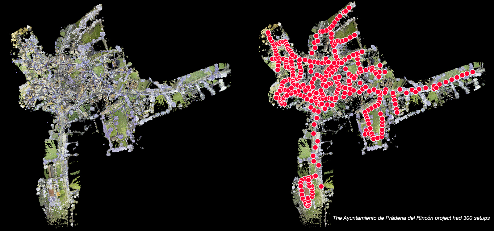
In terms of the requirements for the project, the Leica RTC360 3D Laser Scanner was chosen as the right solution. The highly portable RTC360 was chosen based on its range and accuracy, which was appropriate for the scale of the project, consisting of 300 setups. It was also set to improve productivity and enable better-informed decisions directly on site.
Carlos G. Guillermo Ramírez was the architect for the Ayuntamiento de Prádena del Rincón project. He comments: “The RTC360 is user-friendly and easy-to-use. Anyone that has basic skills can operate it. The laser scanner exceeded my expectations and achieved all project goals from the start. I made the right choice with the RTC360 and will certainly use it for future projects.”
The data was processed in point cloud registration software, Leica Cyclone REGISTER 360, to deliver accurate results and visualise the data in detail. This software can be used as a standalone application or alongside other applications, with Ramírez and the team conducting additional registering, cleaning, improving and publishing to LGS format using Leica Cyclone PUBLISHER Pro. This allowed them to efficiently manage the entire data in a single file and import IFC 3D models. In addition to Leica Geosystems’ software, the team also used Autodesk ReCap, AutoCAD and Revit as part of their everyday design workflow.
Creating 3D models from panoramic photography of the environment
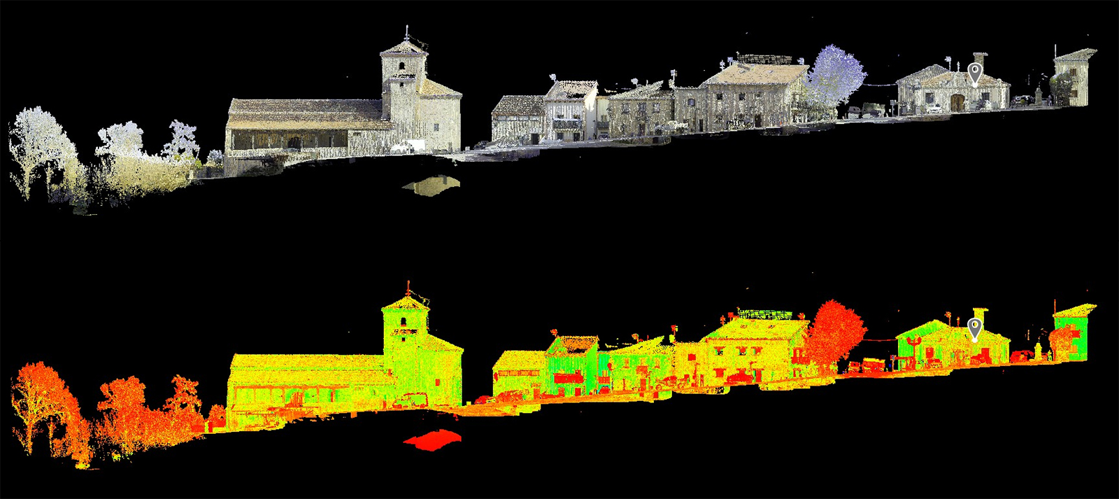
While combining the information from the point clouds and the photography creates detailed plans, Leica TruView Digital Reality Viewer was also employed to easily share point cloud data, design models, and markups. TruView products enable anyone in the project ecosystem to access, view, analyse, and collaborate using digital reality data. It operates via an easy-to-use interface, with no CAD or 3D skills required, enabling all members of the project team to access the digital reality environment from anywhere, at any time, from any device.
TruView also enables its users to make measurements on panoramic photographs at any point in the entire village, allowing the creation of 3D models to evaluate housing designs and projects on the actual village site. Further virtual tours and simulations of any future projects can be created from these results.
Ease of use and speed for smart village models
This solution from Leica Geosystems was ideal for the Prádena del Rincón project because it fit the project’s needs in terms of detail, range, and speed. Most importantly, with this particular project’s environment and history, the technology helps to measure and provide sustainable communities for the future.
Guillermo Ramírez continued: “We selected Leica Geosystems products due to the confidence with their devices and the easy/seamless workflow on the field and at the office. Leica Geosystems staff were very valuable in this project, from the first time they were involved, showing us their different solutions, to helping us achieve our goals or add more value to our deliverables.”
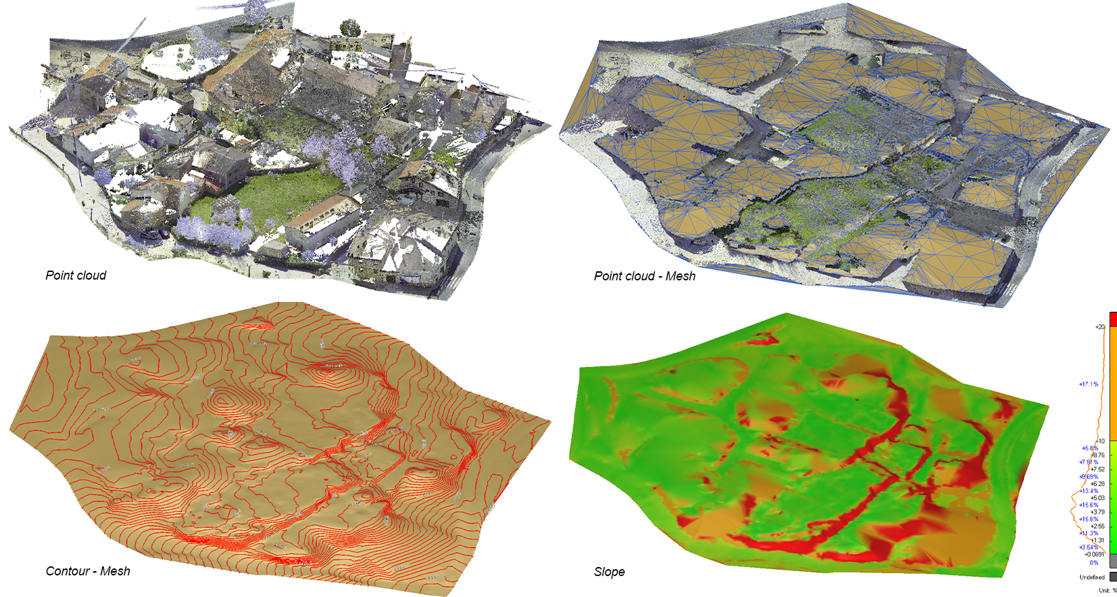
All the data gathered from in and around Prádena del Rincón is creating cartography, floor plans, and elevation plans, which can then be used to create digital elevation models and site design simulations. The remainder of the villages, also part of the Sierra del Rincón Biosphere Reserve, are now set to follow the same data capture and documentation path - passing on the knowledge and best practices gained from Leica Geosystems technology to village neighbours.
The project’s ultimate goal is to use the data captured to create a ‘Smart Village’ model for better, faster and more efficient management of village planning processes in the future.


