Navigating sites with GNSS paperless plans
Case study

Renata Barradas Gutiérrez
According to a study by Roland Berger, 70% of the time on construction sites is spent on coordination and preparation and only 30% is spent on construction. Most of the tasks involved in the preparatory work of a construction site are recurrent and easy to automate or streamline. Aware of this and looking to increase productivity on construction sites Martin Beiganz, Marco Eigletsberger and Christian Obermayr, developed SitePlan – the world's first collaborative navigation and surveying app for civil engineering. SitePlan founders saw the need to increase productivity on construction sites through digital collaborative platforms for civil engineering and created an app that allows construction teams to navigate construction plans with their own mobile devices.
“Our goal is to drive the lagging digitalisation of the civil engineering industry. However, digitalisation is a process that cannot be forced, but must grow of their own accord. That’s why we have to create certain incentives for people onsite, or more specifically, we have to create simple digital tools that relieve them of tedious tasks, such as manual measuring, tensioning a construction twine or orientate yourself in huge paper plans,” said Martin Beiganz, civil engineer and co-founder of SitePlan.
A digital 1:1 georeferenced template

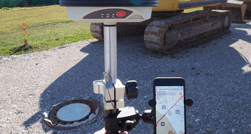
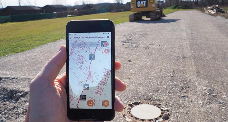
PDF blueprints are usually the interface between planning offices and construction companies. SitePlan creators found a way of making the reading of blueprints more attractive. The SitePlan app allows users to quickly and easily convert traditional PDF blueprints, such as channel plans and road plans into GPS maps. By simply connecting a smartphone or tablet to the Leica GG04 plus smart antenna, construction teams can navigate and position on the blueprint with centimetre-accuracy using their tablets and smartphones.
The GG04 plus is a rugged, flexible and easy-to-use GNSS smart antenna that uses RTK and Precise Point Positioning (PPP), making high-accuracy data collection possible in real-time even in the most demanding of locations without the need for a mobile data connection. The Leica Zeno Connect app which runs on iOS, Android and Windows platforms allows for configuration of correction sources and delivers high-accuracy position to third-party software applications.
“We were looking for a GNSS antenna that can be paired with iOS and Android devices while ensuring high accuracy, reliability and ease of use. The antenna must be integrable into SitePlan’s third-party software,” said Marco Eigletsberger, software engineer and co-founder of SitePlan.
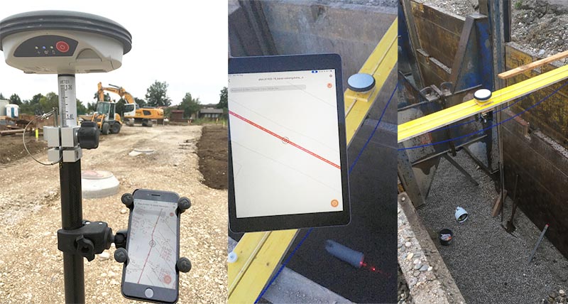
Objects on the blueprints, such as shafts, pipes and road edges can thus be staked out simply and quickly – PDF blueprints become a digital 1:1 template for the construction site. The GPS cloud-based SitePlan platform also provides features for smooth collaboration within the construction team through real-time information sharing, such as GPS-based photo documentation. Thereby all photos taken onsite are automatically located on the blueprints.
“When developing the user interface of our app, simple and intuitive usability was a top priority,” said Christian Obermayr, frontend engineer and co-founder of SitePlan.

To guarantee full compatibility with the Leica GG04 plus, Leica Geosystems, part of Hexagon did software cooperation with SitePlan. The collaborative navigation and surveying app for civil engineering also relies on HxGN SmartNet, a GNSS correction service built on the world’s largest reference station, to quickly determine precise positions even down to the centimetre.
“Leica Geosystems stands for quality. Quality is a must when it comes to responsible activities such as staking out points,” said Beiganz. “We are very satisfied with the Leica GG04 plus as it delivers exactly what we were looking for - high accuracy, reliability, ease of use and very high quality.”
Navigating and staking out

Site manager, foremen, and skilled workers of PORR AG, one of the leading construction companies in Europe, have been using SitePlan and the GG04 plus in various sewage construction projects in Austria. Foremen have staked canal routes without any paper plans onsite to construct a 500-metre sewer collector, and staked manholes, water lines and house connections in the construction of sewers for newly-developed housing estates.
“Foremen and skilled workers have staked out various channel pipes, water pipes and house entry pipes easily and quickly with high accuracy and without the help of surveying experts or manual measuring. All we needed was a conventional PDF blueprint, our own mobile devices, the SitePlan app and the Leica GG04 plus.
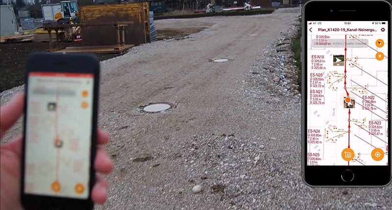
“In the construction of all manholes and house connections, we noticed a considerable increase in productivity because there was no need to insure the staked-out points before the excavation work or to tension a construction twine for measuring. Thanks to the GPS-based photo documentation, all photos taken onsite are automatically located on the blueprints.
"I know exactly what was going on in a certain place at a certain time and what was built there. Especially when it comes to providing evidence for construction accounting, this is of great help. Furthermore, it takes very little time to train people in the use of GG04 plus and SitePlan as it is very easy to use,” said Simon Wohlmutheder, site manager of PORR AG.”
“SitePlan is the ‘Google Maps’ for the construction site. A look at the smartphone that shows my position on the plan, is done much faster than a look at any paper plan on which I first have to orientate myself. With SitePlan – even with the internal GPS signal of the smartphone - I always know where something has to be built in a very short time and where the underground utilities run, so as not to damage them during excavation work.
“Thanks to the combination of SitePlan and the Leica GG04 plus, the laborious manual measurement work is finally no longer necessary. The workflow is very fast and smooth. Simply connect your smartphone to the Leica GG04 plus via Bluetooth – open the blueprint in the SitePlan app and then your centimetre-accurate position is shown on the georeferenced plan with a crosshair – move to the point you want to stake out – Done!” said Reinhold Schnelzer, PORR-foreman with more than twenty-five years of experience.
Building on the existing product, the SitePlan team is already developing other innovative features, such as GPS-based task management and GPS-based onsite measurement for accounting. Since SitePlan and the GG04 plus can not only be used in sewer construction work, but in all areas of civil work, various European construction companies will now implement further projects in the areas of roads, railways, dams, water and earthworks with the GG04 plus and SitePlan solution.
“The digitalisation of the construction industry is in its early stages and there is still a lot to do. We are really looking forward to the challenges ahead and it gives us great pleasure to help shape the digitalisation of the civil engineering industry with simple digital tools made for people onsite,” concluded Beiganz.


