How ESTEIO is introducing airborne hybrid data in Brazil with Leica CityMapper

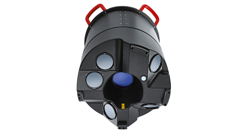
Brazilian aerial survey company ESTEIO Engenharia e Aerolevantamentos S.A has purchased a Leica CityMapper hybrid airborne sensor. The high-performance oblique imaging and LiDAR solution provides the highest productivity for urban mapping, allowing ESTEIO to address the growing demand for 3D data. In 2020, ESTEIO purchased a Leica ADS100 large-format imaging sensor. With the CityMapper, the firm expands its capabilities and becomes the first airborne company introducing airborne hybrid technology in Brazil. The Leica Geosystems team interviewed Valther Xavier Aguiar, Chief Technology Officer at ESTEIO, to get some insight into the company’s latest purchase.
Why did ESTEIO decide to invest in a hybrid sensor?
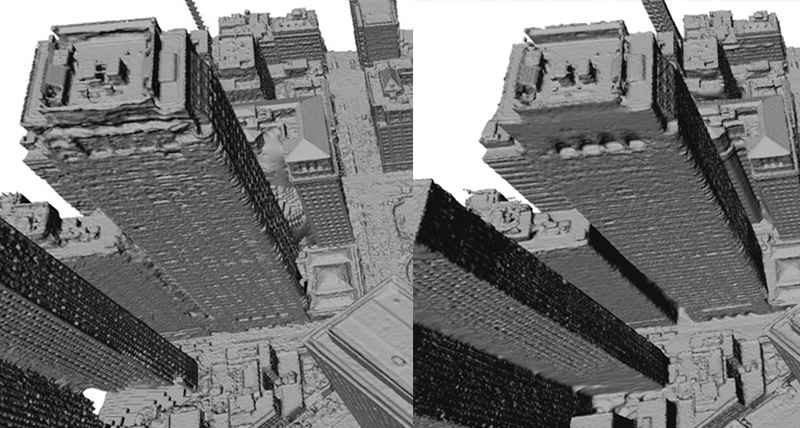
All decisions for major investments are made by evaluating a combination of factors such as risk, need, opportunity and strategy. In 2020, ESTEIO made a major investment in the Leica ADS100 large format imaging sensor. At the time, we were already considering investing in a new LiDAR sensor. With the increasing demand for new services, and particularly for capturing cities with oblique cameras, 3D modelling and a higher point cloud density, it became necessary not only to master the technology but to also have equipment developed specifically for this purpose, providing great reliability, precision, and productivity. In 2016, ESTEIO pioneered performing the first photogrammetric oblique flights in the country with a non-hybrid Leica RCD30 Penta Oblique sensor, which preceded the CityMapper. Since then, the technology was consolidated, and oblique imaging and 3D urban models have been adopted by many cities around the world.
ESTEIO already has laser technology, so why purchase a new sensor?
ESTEIO had three LiDAR sensors, including two Leica ALS50-II sensors with an operating frequency of 157 kHz. We are now acquiring the new Leica hybrid sensor that contains the Hyperion2+ 2,000 kHz laser scanner – capable of emitting and measuring two million LiDAR pulses, or points, per second – that is, this new sensor it is nominally thirteen times more productive than our last sensor and eighty times faster than the first equipment purchased in 2001. We are seeking to increase the quality and productivity of our services and, if possible, to lower our prices, thus increasing our competitiveness. The laser sensors currently operating in the country generally have an operating frequency below 500 kHz, with only a few exceptions.

Why do you say: “if possible, to lower the price”?
Because that is not always what the market demands. We have noticed a trend where contractors demand more advanced technology and improved quality, rather than just cost reduction. That is, they aim to maximize their services with a pre-determined budget. This is evident in cities like Curitiba and Porto Alegre, which recently awarded contracts for airborne survey services using the Technique and Price evaluation method. In this perspective, higher scores were given to the bidders who offered additional advantages. While the lowest price is always desirable, technology enhancements such as higher LiDAR point cloud density, increased image resolution, oblique imaging, three-dimensional models, are highly desirable in the contracting process. However, if the objective is solely to reduce costs without requiring any significant technological enhancement – for example, the customer requires the same point density on the terrain – our new sensor can fully meet this demand with a lower price and faster execution.
Is the Leica CityMapper hybrid sensor to be used in cities only?
Yes, and no! When considering its full potential, combining LiDAR, nadir and oblique images simultaneously, the CityMapper represents an exceptional tool for urban mapping. However, the LiDAR and nadir imaging are also highly efficient for various other applications such as corridor mapping, forestry, mining, and, thanks to a maximum operating height of 5,500 meters, large-area mapping projects. Moreover, the CityMapper offers the flexibility to adjust the LiDAR’s angle and, potentially, to change the focal length of the nadir camera. This unique feature allows customers to adjust the field of view to support a wide variety of use cases.
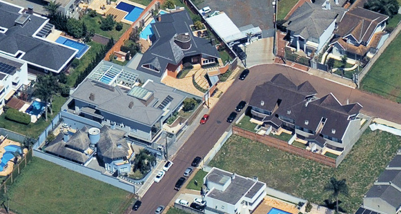
 One of the first oblique images collected by ESTEIO with Leica CityMapper – GSD 12 cm
What makes ESTEIO believe that Brazilian cities will adopt this technology?
There are countless cities around the globe that have already implemented and even reconstructed their 3D city models. It’s crucial for any city aspiring to become a smart city, or even that already is, to use this tool. A perfect example is The Netherlands, which has covered its entire territory with oblique images and built a comprenhensive 3D model, with a land surface of more than forty thousand square kilometers. Among others, many European, Japanese and Korean cities have employed this technology to generate digital twins of their urban environments. Considering these advancements, it seems to us that it is only a matter of time before Brazilian cities also widely adopt this transformative technology.

To learn more about ESTEIO, visit their website.


