Experience the world of 3D using Leica Infinity to manage and post process data from Leica FlexLin

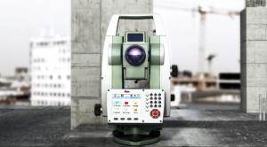
The Leica FlexLine total station is know as a true workhorse. It offers users reliable technology with straightforward manual simplicity. It’s ideal for any standard measurement tasks that don’t require automation or robotics. The Flexline total stations use the dependable Leica FlexOffice software for managing their data and post processing. But did you know that data collected by Leica FlexLine total stations can be managed back in the office using the cutting-edge technology of Leica Infinity v1.3 software?
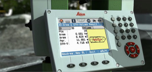
Using FlexLine’s USB stick to transfer data from the field to the office, traditional surveyors can now combine their collected data back at the office to have that Infinity “experience”.
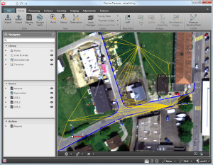
Using Infinity’s intuitive interface allows adding visuals for easy management of FlexLine data.
FlexLine users can now step into the world of 3D using Infinity.
What is the Leica Infinity experience? For FlexLine users it is, quite frankly, an eye opener. It’s the positive user experience that Leica Infinity offers. The easy-to-understand user interface lets user import and edit their FlexLine collected data in one centralised project view. And best yet, Leica Infinity offers FlexLine users easy low-risk access to the world of 3D measuring visuals.
Although FlexLine users have a somewhat less streamlined workflow than when using Leica Infinity with a MultiStation, using this software for managing FlexLine collected data enables surveyors to take advantage of many exciting features and options. For example, Leica Infinity users who also have an active maintenance contract will have access to HxIP, a highly accurate, cloud-based imagery program from Hexagon that adds even more spatial awareness to data and eliminates the need to geo-reference data to a basemap.
Also Infinity’s user experience, with its focused data display options, makes it easier and faster to cross-check projects to make much faster decisions. Users can follow projects much easier from the office working with its clean simple layout, quickly editing data sets and integrating them with other survey results.
Field crews have better understanding of projects and jobs are completed faster because project data is easily visualized. And of course all steps of a project are documented, creating more transparency for the decisions to be made and taken.
Fact: Leica Infinity brings to the FlexLine customers a state of the art data management tool to keep up with today’s demanding project requirements.
More on Leica Infinity here:
Add cutting-edge technology to your FlexLine total station.


