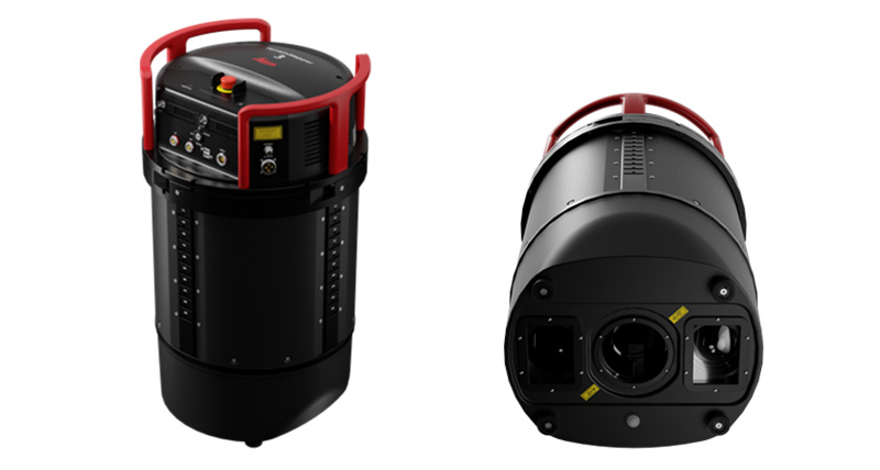
CGR first to purchase Leica TerrainMapper-3 airborne LiDAR system
CGR becomes the first worldwide to adopt the Leica TerrainMapper-3 linear-mode LiDAR system
CGR (Compagnia Generale Ripreseaeree), based in Italy, becomes the first worldwide to adopt the Leica TerrainMapper-3 linear-mode LiDAR system to support a wide variety of projects across the country and abroad. The company has a strong, long-standing partnership with Leica Geosystems, and they already operate a Leica TerrainMapper, a Leica DMC-4, a Leica DMC III and a Leica CityMapper-2 systems.

The TerrainMapper-3 features an adjustable field of view of up to 60 degrees, a narrow beam divergence, high scan speeds and three configurable scan patterns, optimising data collection and enabling users to customise the sensor’s performance to specific projects. The system is further enhanced by Leica MFC150 4-band camera, which covers the full field-of-view of the LiDAR, ensuring exact data consistency.
CGR is taking full advantage of the TerrainMapper-3’s performance to enhance productivity across a wide range of applications and flying heights, from wide-area mapping to vegetation studies and high-point density corridor projects. With the system supported by Leica HxMap’s end-to-end workflow and new sensor pod design, CGR seamlessly adapted to the new technology and began operating the TerrainMapper-3 just days after first installation.

Giovanni Banchini, CGR President and CEO, states, “The TerrainMapper-3 delivers maximum collection performance while streamlining operations for every mapping mission. The investment in the new system reaffirms our dedication to surpassing customer expectations with the highest-quality LiDAR data and imagery and strengthens our more than fifty years of collaboration with Leica Geosystems”.
John Welter, President of Geospatial Content Solutions at Hexagon’s Geosystems division, adds: “The Leica TerrainMapper-3 is a unique combination of versatility and performance, allowing users to tackle a wide variety of mapping projects with a single system. CGR’s adoption of this technology reflects their dedication to delivering exceptional geospatial data. We are proud to support their mission with a tool that maximises productivity and pushes the boundaries of airborne LiDAR innovation.”


