70 Miles of highway mapping to full engineering design in 99 days
Case study

Author: Penny Boviatsou
E.L Robinson Engineering, a civil engineering and planning firm with 40 years of experience in transportation planning, analysis and design, was selected by West Virginia Department of Highways (WVDOH) in the United States to complete a demanding 70-mile highway mapping project in only 99 days.
This transportation project had no existing as-built map. To meet the timeline, the data had to be collected by mobile mapping, including:
- Mapping a 70-mile, two-lane highway
- Static scanning of 12 bridges
- Curve widening and slide repair
- Creation of the Digital Terrain Model (DTM)
- Extraction of topographic features, such as edge of pavement, striping, signage and utility poles
- Culvert survey and inspection of more than 500 culverts and pipes
- Setting permanent control for bridges.
Keeping pace with demanding deadlines

Given the short delivery time of full design deliverables, E.L. Robinson Engineering began with the mobile mapping data acquisition immediately. The challenge was with completing the engineering deliverables needed from the mobile data – this is where the Leica Pegasus:Two mobile sensor platform user network provided a significant advantage. Rice Associates, Inc., a geospatial services firm that provides conventional surveying, in-house photogrammetry, static, mobile, and terrestrial LiDAR scanning, also owns Leica Pegasus:Two mobile sensor platform. The company was able to support E.L. Robinson Engineering with the data extraction capacity to help meet the project timeline.
“Surveying a highway requires capturing enormous amount of data with the highest precision and standards. The Leica Pegasus:Two enabled us to collect millions of points per second; the team mapped 5 miles per day, and it took us only 14 days for the complete data extraction of the 70 miles of a two-lane highway,” said Obadyah Foord, regional director at Rice Associates.
Given that both companies, E.L. Robinson Engineering and Rice Associates, use the same hardware and software, the data integration and exchange were seamless; bringing scheduled delivery of data and keeping engineers moving forward into final design without delays.
Thriving on a challenging project

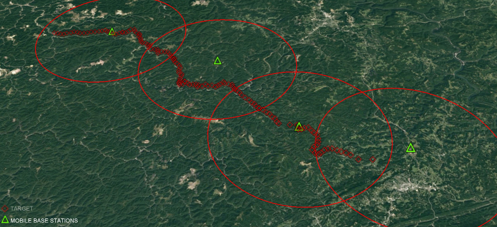
A total of 36 Real Time Kinematics (RTK) base stations were used for this project to locate targets and other topographic features. While 120 mobile scanner targets were used to control the mobile scan, these were scanned at 40 kilometres per hour with a target every 610 metres. A DTM was created for the highway design, which included:
- The raw point cloud
- Isolated ground points
- A triangulated surface mesh.
“The surveyors working from the office were able to create traditional topographical surveys from the point clouds and images,” said Tom Rayburn, manager of surveying at E.L. Robinson Engineering. “7.8 billion raw data points were collected, and we produced in 45 days the DTM, edges of pavement, guardrail, utility poles and signage for the entire length.”
“The Leica Pegasus:Two provided a rapid data capture solution for this large-scale project, saving us time and reducing safety risks,” said Rayburn. “With Rice Associates support, we delivered the project on time and within budget thanks to the speed and accuracy delivered by using the Pegasus:Two.”
Tilmeld dig Leica Reporter
Kontakt Leica Geosystems
Ønsker du at vide mere? Vi er her til at hjælpe og vejlede dig.
Ønsker du at vide mere? Vi er her til at hjælpe og vejlede dig.


