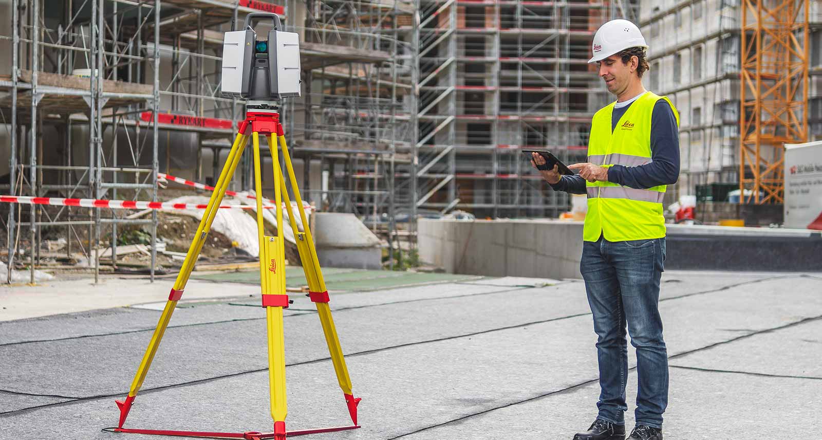
Leica ScanStation P40 / P30 - High-Definition 3D Laser Scanning Solution
Integrated 3D laser scanning solution providing unsurpassed speed, accuracy and range for demanding scanning projects

Leica ScanStation P-Series 3D laser scanners are your perfect partner when capturing 3D geometry of civil infrastructure, creating an as-built representation of a large industry complex, reconstructing a crime scene or generating 3D data for integration into Building Information Modelling (BIM). As part of the Leica Geosystems 3D Reality Capture solution, the Cyclone FIELD 360 app now links the 3D data acquisition in the field with the ScanStation P-Series laser scanner and final data registration in the office with Cyclone REGISTER 360. One-site, users can now automatically capture, register and examine scan and image data.
Leica ScanStation P30/P40 deliver highest quality 3D data and High-Dynamic Range (HDR) imaging at an extremely fast scan rate of 1 million points per second at ranges of up to 270m. Unsurpassed range and angular accuracy paired with low range noise and survey-grade dual-axis compensation form the foundation for highly detailed 3D colour point clouds mapped in realistic clarity.

The right choice
Whether you need a detailed as-built representation of a façade, a 2D floor plan, 3D data for integration into Building Information Modelling (BIM), capturing 3D geometry of roads, rails, tunnels and bridges or high-definition scan data for topographic maps and as-built surveys, you know you’ll need an accurate long range scanning tool for your projects – the ScanStation P30/P40 laser scanners from Leica Geosystems are the right choice, because every detail matters.

High performance
Reducing downtime, the extremely durable 3D laser scanners perform even under the toughest environmental conditions, such as extreme temperatures ranging from – 20°C to + 50°C and comply with the IP54 rating for dust and water resistance.

Complete scanning solution
Leica Geosystems offers the Leica ScanStation portfolio as an integrated part of a complete scanning solution including hardware, software, service, training and support. 3D laser scanner data can be processed in the industry’s leading 3D point cloud software suite, which consists of Leica Cyclone stand-alone software, Leica CloudWorx plug-in tools for CAD systems and the free Leica TruView.

ScanStation P30/P40 delivers
- Highest quality 3D data and HDR imaging
- Extremely high speed scan rate of 1 mio points per second
- Ranges of up to 270 m
- Low range noise
- Survey-grade dual-axis compensation
- Highly detailed 3D colour point clouds mapped in realistic clarity

Get the App today!
The Cyclone FIELD 360 mobile-device app is free to download. A valid Cyclone REGISTER or Cyclone REGISTER 360 licence is required to activate Cyclone FIELD 360 as the login credentials are the same. Download the Cyclone FIELD 360 app from the App Store and Google Play.
Want to know more about our P-Series laser scanners?
Get in contact with us for more information about our laser scanning portfolio.
How-to configure the instrument
The Leica ScanStation P40 terrestrial laser scanner offers various settings for configuration, e.g. date and time, units and language. This video shows how to define these settings for an initial configuration.
How-to start a scan
Learn about the Leica ScanStation P40 scanning process from start to finish and which key settings are vital for a scan definition.
How-to use the Scan Viewer
See how the Scan Viewer of the Leica ScanStation P40 can be used as an essential tool for a quick and easy definition of sub-scans and a quick check in the field.
How-to acquire images with the internal camera
Learn from this how-to video how the internal camera of the ScanStation P40 creates high quality images for the colour mapping of scanned 3D point clouds.
Introduction to Laser Scanning
Chapter 1 - The Basics
Introduction to Laser Scanning
Chapter 2 - How It All Works
Introduction to Laser Scanning
Chapter 3 - Projects
Leica ScanStation P30/P40 3D Laser Scanners
Watch Juergen Mayer, Business Director Terrestrial Laser Scanning talk about Leica Geosystems laser scanning family of products.
Laser Scanning Technology
How does laser scanning technology transform the construction industry?
JTRS Registered Surveyor
Providing high-quality and timely services to customers with maximum simplicity and detail.
Expert Insight
4 videos to easily get started with the ScanStation P40
Have you calibrated your P-Series ScanStation lately? Reasons you should get a Bronze or Silver Certificate
Introducing the Double Scan Feature for ScanStation P-Series
Extending the 3D Reality Capture Workflow
Leica Cyclone FIELD 360 Quick Plan simplifies modelling workflows
Integrating the well-known Traverse workflow into 3D laser scanning technology
Familiar surveying workflows onboard Leica ScanStation P-Series 3D laser scanners
Customer Insight
Digitalising from planning to execution
How Johnson's County is recreating crime scenes with laser scanning
Revolutionising smart factories with reality capture


