The faster road to mobile data capture
Customer Profile

Author: Tamara Stakic, Marketing Manager- Leica Geosystems, Australasia
Veris Australia (Veris), the largest provider of surveying and spatial information services in Australia, with almost 500 professionals located across 20 offices, is no stranger to servicing large multi-faceted projects. The company has a track record going back 60 years of delivering projects in private and public sectors on a national scale spanning across energy, mining and resources, residential, commercial and retail industry just to name a few.
To deliver market-leading planning, design, surveying and spatial solutions Veris recognises that digital and spatial technology innovation increases value, enhances the quality and boosts productivity for project delivery. Access to the latest technology allows the company to provide the best quality data and services to their clients as part of their 3D Spatial services.
Going mobile: A case for Leica Pegasus: Two

Recently the Veris Digital and Spatial team reached out to Leica Geosystem Australia and New Zealand to upgrade their existing Mobile Laser Scanning (MLS) systems to increase processing efficiency with the new Leica Pegasus:Two Ultimate Mobile Sensor Platform. “With the recent improvement of trajectory processing and image acquisition, the Leica Pegasus: Two Ultimate Mobile Sensor Platform was the perfect mix of data quality and functionality for Veris,” said Brad Chambers, National MLS Manager at Veris. “The high-quality image collection adds another aspect to MLS that our client’s value.”
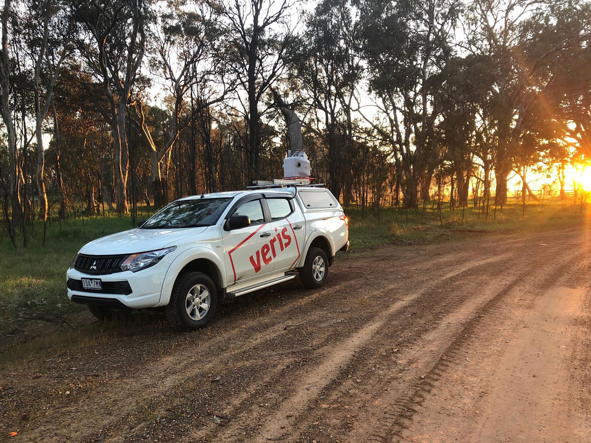
Since acquiring two Leica Pegasus: Two Ultimate systems, Veris have deployed the solution for projects within highly trafficked roads or freeways that are typically more challenging and time-consuming to survey using methods such as total stations, GNSS or Terrestrial Laser Scanning.
“We believe with the improved efficiencies we are now 50 per cent more efficient on the post-processing of the point cloud data. We’ve become more productive as we no longer need to deploy an experienced operator to site, something we’ve had to do for many years - saving us time and the need to fly to site,” said Chambers.
With their two new Leica Pegasus: Two Ultimate systems and improved imagery, Veris can capture projects for road and rail pre-construction dilapidation, asset management, crack detection and machine learning applications. The Leica Pegasus: Two Ultimate incorporates two back-to-back cameras creating a 24 MP 360-degree image calibrated to the LiDAR profiler data and allows capture in a variety of lighting conditions and vehicle speeds. Photogrammetry and image quality are impressive with twelve megapixels and onboard JPEG compression.
While there are major productivity gains that come with deploying the Leica Pegasus: Two Ultimate on projects such as capturing high-density 3D point cloud data along with high-resolution imagery without needing to step outside your vehicle, there are safety benefits such as eliminating danger zones and significant health and safety risks by capturing data without the need to close roads, stop trains, interrupt service networks, and the need to survey at night.
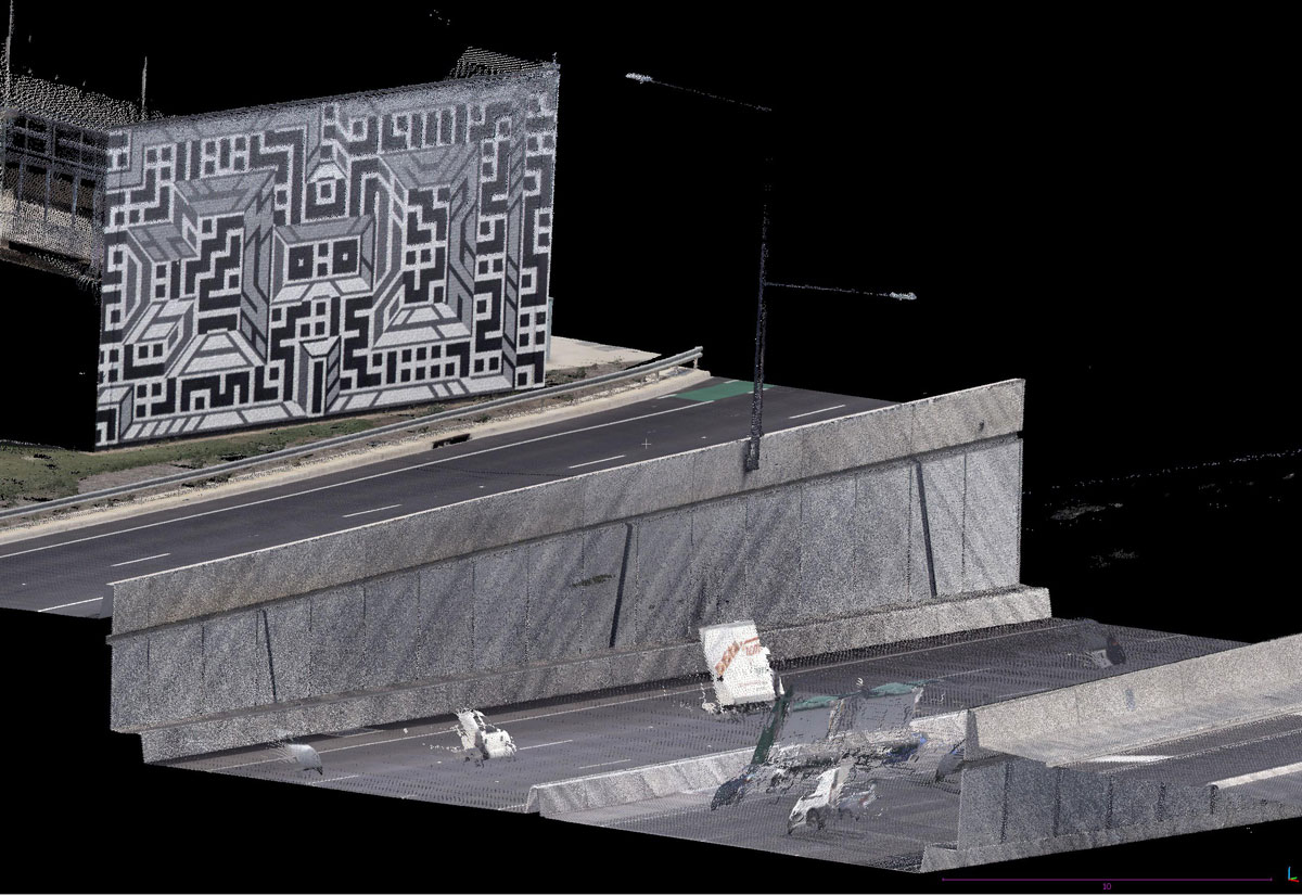
One of the applications the Leica Pegasus: Two Ultimate excels at due to the high-resolution imagery is pavement and road inspection. Veris put this to the test on a recent project involving a 3-kilometre-long section of the freeway for pavement monitoring, to enable the assessment of flexible pavements in highly reactive soil types. The main challenge with this project is that the main section of the motorway was lowered approximately 10-18 metres below ground level in a GNSS-denied zone. With adequate survey control and as-built information (static structures at 20-meter intervals) Veris was able to adjust the point cloud to <5mm of the survey data both horizontally and vertically.

Veris captures a 3-kilometre-long section of the freeway in Adelaide, Australia for pavement monitoring.
Point clouds provide a comprehensive view of the real world, and allow the Veris team to extract data to meet client needs, without needing to return to the site to collect data - this level of detail could not have been captured in the same amount of time using traditional survey practices. In this case, Veris’ client was able to use the data captured to assess if any profiling is required before the final layer of asphalt is placed to ensure correct layer thickness.
Onboarding the Leica Pegasus:Two Ultimate
One of the most important aspects when evaluating options for a mobile mapping unit for Veris was strong local supplier support, flexibility in adapting the system to different scenarios and an integrated solution for imagery and point cloud capture – Veris needed a single solution that would help them deliver detailed point clouds and high-quality imagery.
Other aspects that made the Pegasus:Two Ultimate the clear standout is that the system does not need to be installed on a specific vehicle. It can fit the standard roof racks and the ability to run the equipment without a power connection to the vehicle, as the system does not require wheel odometers, so it saves time on set up.
Brad Chambers, National MLS Manager at Veris was closely involved in the decision making, describes their first time taking out the system to site. “The Leica Pegasus: Two Ultimate was easy to set up on a vehicle, with the connection to the system by Wi-Fi using a Veris owned laptop. We were able to send the equipment to the site and have a couple of surveyors (both had not operated MLS before) install the equipment under an experienced operator’s instruction via screen sharing and Webex. A short mission plan was reviewed before the data capture, then a review of the data by the experienced operator before completion.”
And when it comes to getting trained on the Leica Pegasus:Two Ultimate? “For us the training phase of using the Leica Pegasus: Two Ultimate involved the post-processing of missions through to adjustment of trajectories, point clouds and imagery. During a two-day session, we were able to train 12 staff from all states and territories in Australia via Webex. Although this would have been usually done onsite, the solution was excellent given COVID restrictions,” said Chambers.
When asked about what piece of advice they would give to peers considering adding a mobile mapping solution to their fleet, Brad reflected on the need for the operator to prepare in advance for the project and consider all possible scenarios, “as with all technology, there are things that you need to be aware of, MLS is a very challenging surveying activity, and requires an vast amount of effort and understanding of how point clouds and images react in different environments. The Leica Pegasus: Two Ultimate is no different and still requires the operator to think about every scenario; fortunately, the Leica Pegasus:Two Ultimate makes this easier with its post-processing workflow.”
The road ahead for Veris

The efficiency gains are also getting noticed by clients. “We’ve already seen an increase in mobile mapping projects on the east coast of Australia and our clients are happy with the highly detailed data and impressive imagery. A key client in Melbourne was amazed at the turnaround time that we were able to achieve to integrate the Pegasus: Two Ultimate data with the Leica ScanStation P40 data,” said Chambers.
For Veris the survey-grade accurate data available from Pegasus: Two Ultimate creates opportunities to undertake additional and larger projects and grow their service offering. Veris is exploring how the imagery can be leveraged by integrating the multiple pavement cameras for automatic crack detection using machine learning; this will give Veris an additional industry in road analysis that can be leveraged with the Leica Pegasus:Two Ultimate.
As with any new technology, Veris continues to review their outcomes to ensure that delivery to the end clients is exceptional – a commitment to quality is deeply integral to Veris. Find out more about Veris Australia here and connect with Brad Chambers on LinkedIn.


